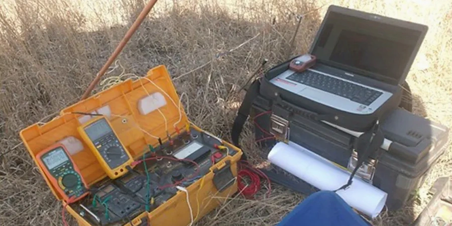
Brampton grew from a small agricultural crossroads into one of Canada's fastest-growing cities, and that rapid expansion across the South Peel Plain means we encounter a real mix of subsurface conditions—glacial till, shale bedrock, and buried river channels that complicate site planning. Before committing to a foundation design or dewatering strategy, you need a clear picture of what lies below without drilling a hundred boreholes. Electrical resistivity testing and vertical electrical sounding (VES) give us that continuous profile of subsurface resistivity, mapping transitions between clay, sand, gravel, and bedrock efficiently. Our crew runs these surveys across residential subdivisions near Heart Lake, commercial infill sites downtown, and industrial parcels along the CN rail corridor, delivering data that helps you avoid surprises during excavation. Combining resistivity data with test pits provides ground-truth calibration at key locations, tightening the interpretation of the geophysical profile.
A VES sounding takes about 90 minutes on site and gives you a layered resistivity model that directly informs groundwater depth, soil corrosivity, and depth to bedrock—three numbers every Brampton foundation engineer needs.
Local considerations
Under the Ontario Building Code, a geotechnical investigation must characterize subsurface conditions to the extent that unanticipated ground conditions don't compromise the design. In Brampton, the risk of missing a buried sand lens or a perched water table is real—the Halton Till can be heterogeneous, and interbedded sand units create artesian conditions in some areas north of Queen Street. A borehole gives you a point measurement; resistivity fills the gaps between boreholes, catching lateral changes that a drill rig can miss. For sites within the Credit River and Etobicoke Creek valley corridors, where fill thickness varies unpredictably, we recommend running at least two VES soundings to bracket the area of concern. This approach aligns with CSA A23.3 requirements for durability design in aggressive soil environments, because resistivity data directly informs the corrosion risk classification for buried concrete and steel. Missing that assessment can lead to premature deterioration of foundation elements.
Common questions
How deep can a resistivity survey investigate on Brampton sites?
With a Schlumberger VES array, we routinely reach depths of 40 to 60 metres on Brampton sites, depending on the maximum current electrode spacing we can deploy. In tighter urban lots, practical depth is typically 25 to 35 metres. That covers the overburden-to-bedrock contact across most of the city, including the thick till deposits north of Bovaird Drive.
What does electrical resistivity testing cost for a typical Brampton residential lot?
Can resistivity surveys distinguish between clay, sand, and bedrock?
Yes, the resistivity contrast is usually clear. The Halton Till clays in Brampton show low resistivity (10–40 Ω·m), sand and gravel lenses read higher (80–300 Ω·m), and the Georgian Bay shale bedrock typically falls in an intermediate range (30–80 Ω·m) depending on fracture density and saturation. We calibrate the geophysical interpretation against any available borehole logs or test pits on your site to reduce ambiguity.
How long does a resistivity survey take, and when will I receive the report?
A single VES sounding takes approximately 90 minutes of field time. A 2D line with 64 electrodes takes about two hours to set up and acquire. For most Brampton projects, we deliver a preliminary resistivity model within one business day and the final interpretive report within three to five business days, complete with depth sections and geological commentary.